Ye Official Collection of Azdhagon Maps

A black-and-white map of the fantasy continent of Freytilia, featuring labeled regions and islands such as Shakunus, Kithus, Linnad, Allacia, Freytilia, Olakhia, Kythia, and Ylinnia, with terrain details like mountains, forests, and water bodies.

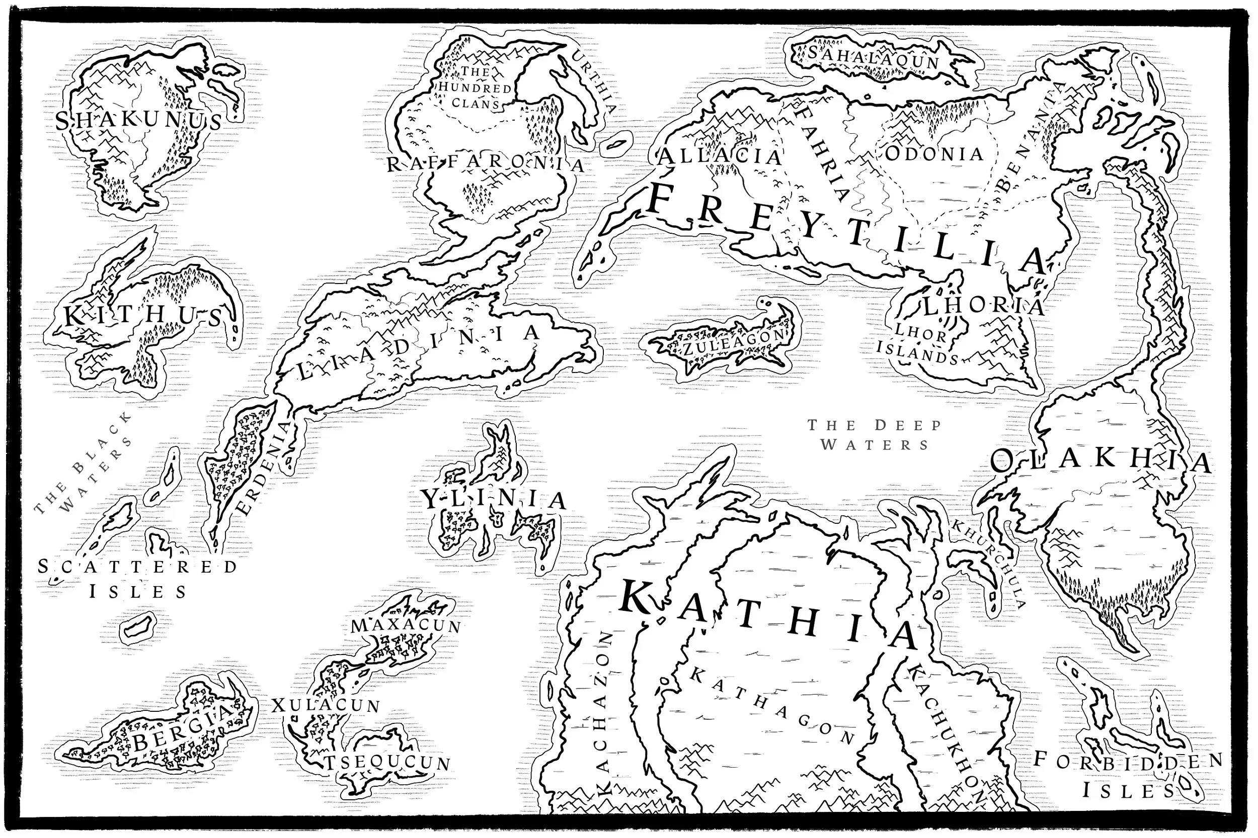
Welcome to "Azdhagon," an ancient Draconian word that, when translated into the Common language, means, "first ground."

Map of West Freytlia showing towns, mountains, rivers, and regions like Plains of Alak and Deep Waters.

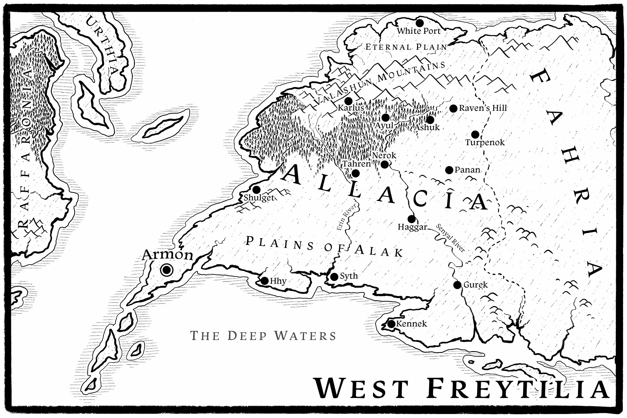
This is a closer look at Allacia, Freytilia's western country. The standalone novel, Bygone, explores the Valashun Mountains.

A detailed fantasy map of a fictional land divided into regions including Fahria, Odonia, Benania, Lhoria, Central Freytlia, and Allaccia. The map shows mountains, forests, rivers, lakes, valleys, and cities such as The Tower, Doman, Loso, Nasha, and Ork.

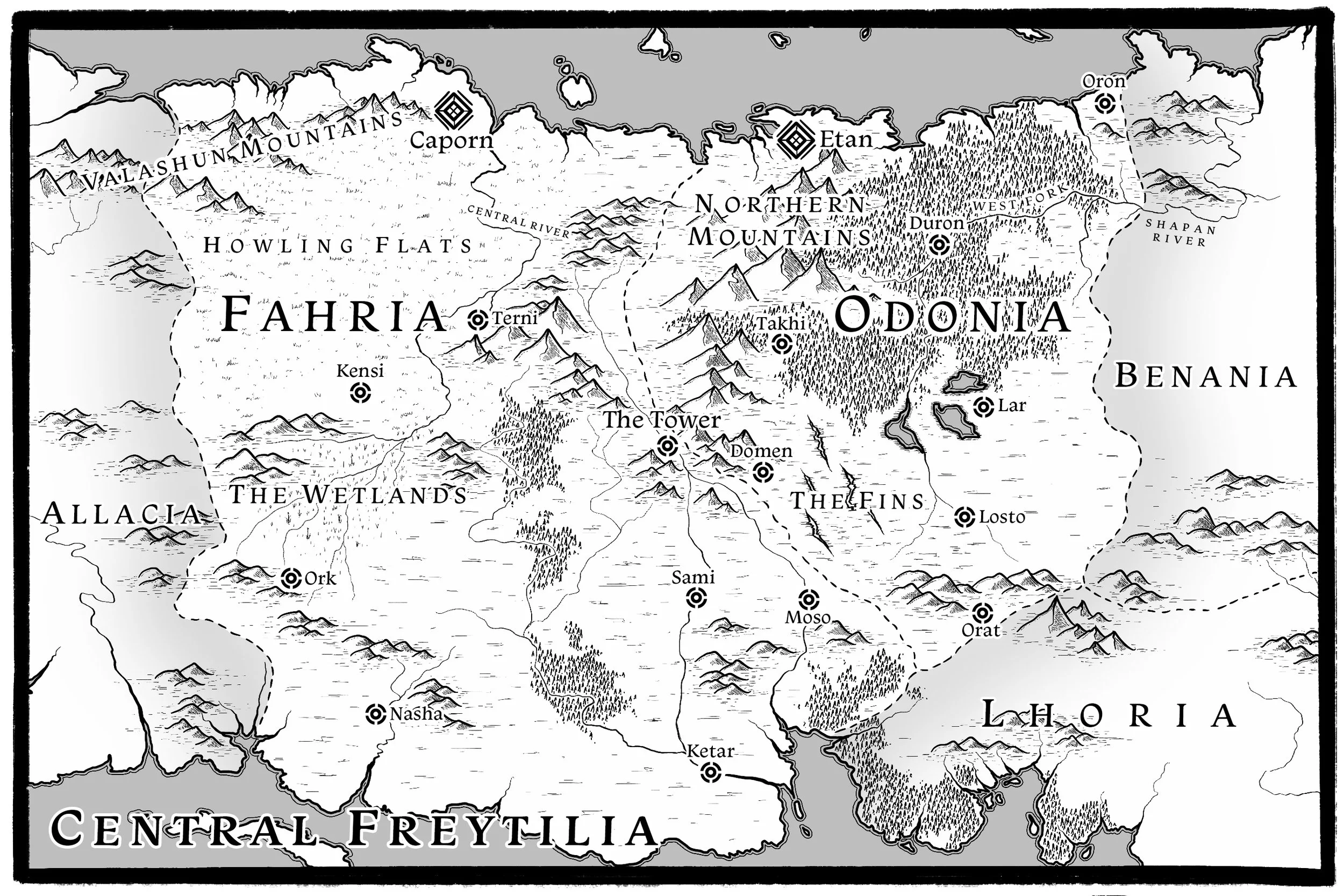
This is central Freytilia, the region explored throughout the Runeborn Trilogy.

A fantasy map of the land of Lhoria, showing regions, towns, and landmarks such as Eastshire, North Port, Enda, Nestin, Lacden, South Port, and various mountain ranges and territories.

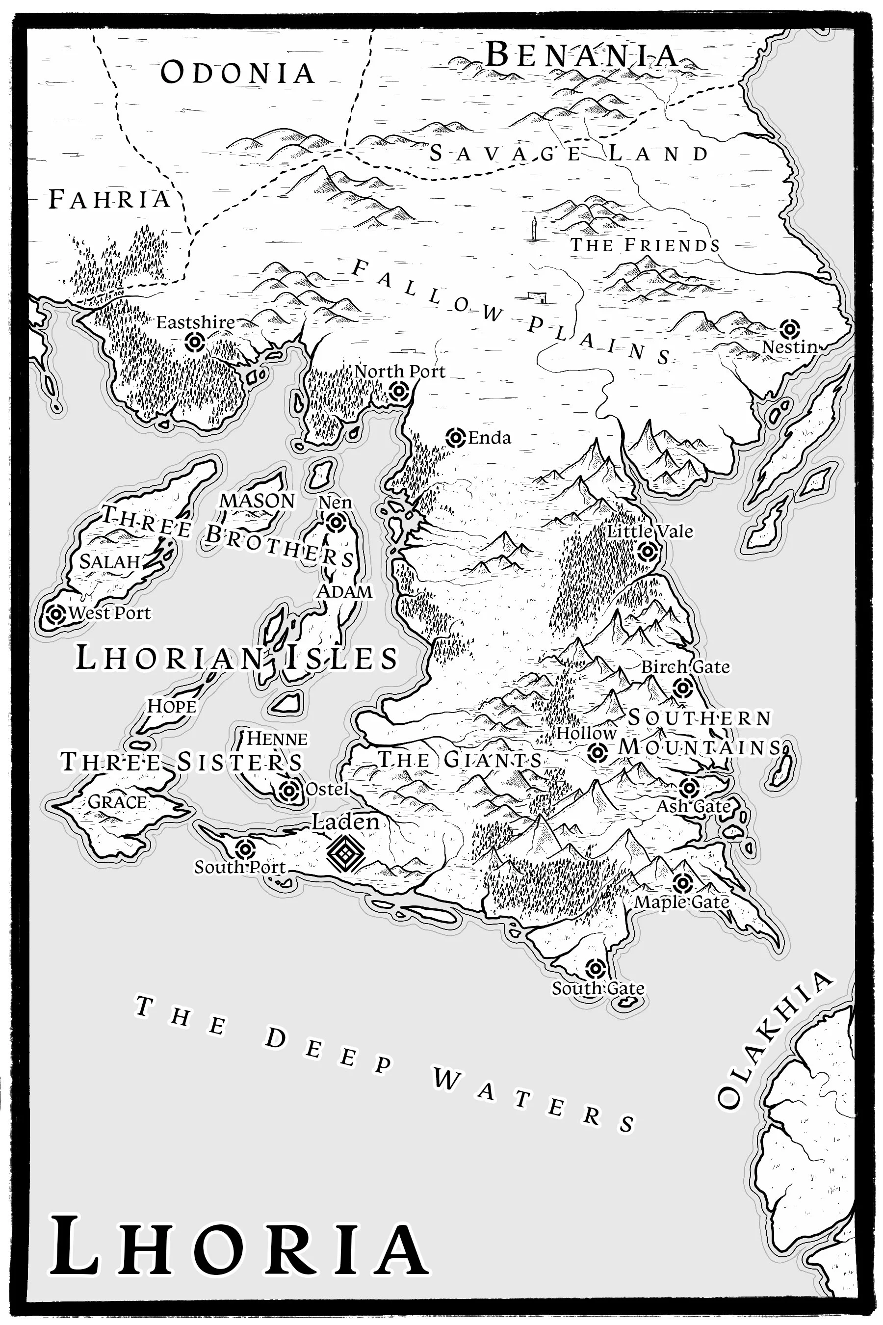
This is southern Freytilia, a region explored throughout the Runeborn Trilogy.

A black-and-white fantasy map of East Freytilia, showing regions, mountain ranges, rivers, and various settlements with labeled names.

This is Benania, Freytilia's northeastern country and the setting for the Low Country Trilogy.